DISCLAIMER: Aloha From 808 is solely created for recreational purposes and NOT intended for use as a guide. Please be responsible and respectful if choosing to visit locations I photograph, as you do so at your own risk and the risk of endangering others. This website and owner will not be liable for injury, medical/legal fees, fines or property damage as a result of viewing. Do not use content on this website without permission (see more).

All photos © 2011-2014 Cory Yap, unless noted.

Wailupe Loop Trail – July 7, 2012


Wailupe Valley is pretty foreign to most people, aside from residents of Hawaii Kai and dedicated hikers. After doing a biological survey of stream life in the lower and middle reaches of the valley for work, I’ve been wanting to explore further back into Wailupe, as well as look for any ridge trails that terminate at the Koolau Summit. I’ve heard the HTMC and a few other hiking enthusiasts have done a loop trail, which goes up the middle ridge in Wailupe traverses north on the Koolau Summit Trail (KST), then descends via the Wiliwilinui trail and jumps back to the valley floor via a steep descent route off of the ridge. After doing much research and some reconnaissance, a large group of us (Baron Yamamoto, Jeremy Kreis, Katie Ersbak, Jenny Ersbak, Kaiser Nonales, Seth Eason, Josh Serrano, Gary Kitahira, Francis Jimenez and Lara were successful in finding and completing the loop trail.


The day started early, at the end of Hao Street and back of the residential area in Wailupe Valley.


The trail into Wailupe Valley is wide and well kept, especially for one that is not a state regulated trail.


Most of the trail is well-shaded throughout in the valley.


About 20 minutes in, we turned off (right) from the main trail at a distinct downhill junction in the valley,


…which lead to a couple of dry streambed crossings.


From here the trail forked again, where we ended up taking the fork in the uphill, mauka-direction.


The ridge we set foot on (which I believe is the middle ridge) quickly gained in elevation and ridiculously steep in several places,


…but at least the humid, closed canopy quickly opened up to an open sky and tradewind breezes.


Though we did pass through a few loose groves of strawberry guava.


After several sections of lung-busting uphill sections, the crew took a break for a group picture… Top (L to R): Jeremy (IG@bob_the_moo_cow), Katie (IG@kersbak), Kaiser(IG@iikaiserii), Seth, Josh(IG@jobu14), Gary(IG@808optics). Bottom (L to R): Jenny (IG@Ersbatch), Baron (IG@808indy), Lara and Francis.


The wide, well-kept trail began to narrow as we approached the native forest higher in the watershed,


…with Koa, Ohia, and Uluhe now being the dominant trailside vegetation. Look how intensely Kaiser is analyzing the striations of the Koa bark. haha.


The last stretch of the middle ridge in Wailupe is another lung buster, being ridiculously steep and somewhat overgrown with Uluhe ferns.


But what lies minutes ahead is the grassy summit of Wailupe Loop trail,


…and epic views of Windward Oahu, including Kaneohe, Kailua, and Waimanalo.


After a few snacks, we packed up and started traversing the Koolau Summit Trail (KST) in the northern direction towards the Wiliwilinui Trail terminus (top of Kamiloiki Ridge).


Unlike several of the previous weekend prior, the clouds today were much higher than the summit of the East Koolau Mountains,


…and provided excellent views while crossing over.


Unlike Josh, Jeremy and Baron, I haven’t been to this stretch of the east KST before, but I was glad that the trail between the two termini was in fairly good condition.


Francis highlighting one of the more narrow sections on our journey,


…just before reaching the summit of the Wiliwilinui Ridge Trail.


We didn’t stay long, since the summit here was muddy… Wailupe’s summit was way more loiter-friendly. Look at how discontent everyone was upon leaving. ;P


The Wiliwilinui Trail is well-established, as it is a State-maintained trail (see here).


Most of the steeper portions of the trail are terraced with wide-set stairs, which make the descent much safer than sliding on your butt through the mud. I don’t summit most of these trails often, but I hear the upper exposed portions of them can get pretty muddy in this area.


Further down the ridgeline, we encountered the “actual” trailhead, indicated by a sign and a boot-brushing apparatus… reminding everyone how important it is to clean your boots before, during, and after hiking in Hawaii’s native forests and watersheds.


As I mentioned earlier, we meant to loop our route back into Wailupe Valley, to the main valley trail. Using a GPS route one of my friends gave me, we found the steep connector trail from the Kamilioiki, back down into the valley. Note, though this trail is flagged and fairly well kept on the way down, there are other marked/unkept/nasty trails that could get you into a lot of trouble. Anyone trying to find this one should be cautious and do their research before attempting.


Back at the junction with the valley trail, I was surprised that I’ve seen this fork several years prior, but never bothered to explore it to it’s summit at Wiliwilinui.


Oh well, but we all did it now, so let’s not dwell in the past… haha.


The trip back out to the trailhead was quick, with the total loop taking us a leisure 5.5 hours to complete… However, the stats of the guy who gave me the GPS track trail-ran the route in 55 minutes. WHO does that?!! Keep doing great things K…-XIV!

We were all super hungry, and what better way to satisfy a bunch of famished hikers with some poke bowls from Paina Cafe!!! 🙂

To view this location on a Google Map also known as my “Adventure Map“, Click Here. For more adventures of the Lost Trailblazers, either look at my other blogposts and “Adventures with the Lost Trailblazers” photo gallery. Thanks for visiting and come back again soon!

Questions??? Just Ask!!!


6 Comments for Wailupe Loop Trail – July 7, 2012


Daniel Hwang

Thanks for sharing your awesome shots of this hike. Did you happen to take any pictures of that bog-like area right before the summit of Wailupe Ridge? I was always too tired to take pictures there, but then again, it’s driving me to do this hike again just so I can see it.

Reply

    Cory

    Aloha Daniel,

    Unfortunately I do not believe I have pictures of the area of the bog you describe. Is it just before the summit or much further down? The last photos I had were going up of the steep segment just before the summit, and the actual grassy summit itself. I do have some of the flatter areas just before the last steep section though. You may just have to go back and snap more photos! haha. Mahalo for visiting my site and for you kind words.

    Aloha,

    Cory

    Reply

Dana hada

I don’t have a gps. Any land marks for the trail that leads to wailupe valley from wiliwilinui. Last time I did wailupe I could not find the trail back down

Reply

Ede

Was researching the Wailupe and your website was the first so I clicked on it,. I guess it helped to have an awesome title “AlohaFrom808″…had to be local. Loved all the pics and although I am not a hiker (don’t like heights) it made me want to be able to do one like this. So U`i and looks like you all had a lot of fun. Mahalo for sharing!

Reply

    Cory

    Aloha Ede,

    Glad you enjoyed the adventure! The hike to the summit is not narrow at all, however the crossover to Wiliwilinui may be considered so. Let me know if have any more questions if you decide to do this. Mahalo nui for your kind words and for visiting my site.

    Aloha no,

    Cory

    Reply

Ede

Was researching the Wailupe Trail and your website was the first so I clicked on it,. I guess it helped to have an awesome title “AlohaFrom808″…had to be local. Loved all the pics and although I am not a hiker (don’t like heights) it made me want to be able to do one like this. So u`i and looks like you all had a lot of fun. Mahalo for sharing!

Reply


Wanna say something?


  Cancel Reply


  • Follow Aloha From 808 on Facebook or Instagram for new photos and weekly adventures!!!

  • Adventures

    • Backpacking (29)
    • Beach / Coastal (46)
    • Climbing / Canyoning (15)
    • Conservation / Restor… (11)
    • Fishing / Diving (22)
    • Hiking (149)
    • International (3)
    • Kayaking (11)
    • Mainland US (17)
    • Streams / Waterfalls (61)
    • Uncategorized (12)
  • Recent Posts

    • Canyoneering: Communication Breakdown
      Recently learning how to rappel from my friend Kitt, I was invited to tag along...
    • East Maui Waterfall Marathon Pt 2
      As a reconnaissance for future adventures with a larger group, Baron and I decided...
    • Twin Falls, North Kauai
      One of my colleagues who lives / works up in North Kauai strongly recommended that...
    • Honolulu 27, Waterfall Loop
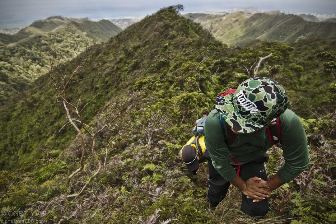
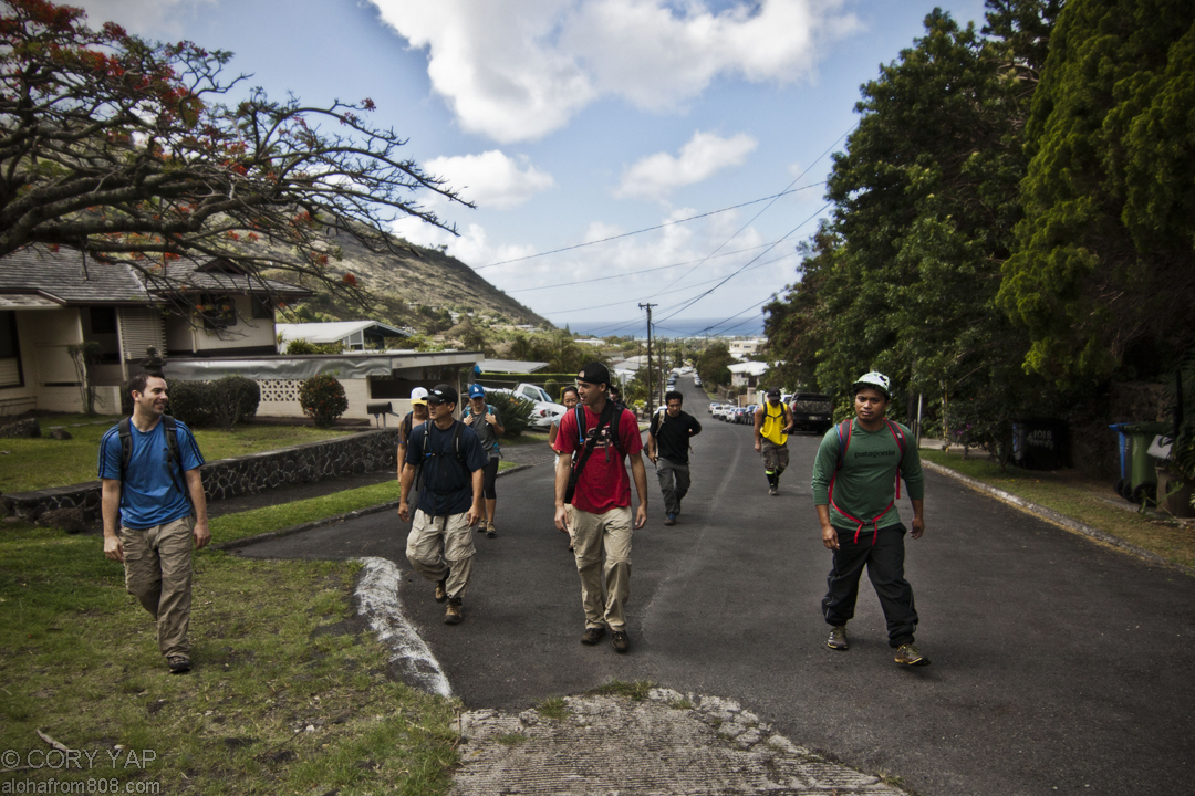
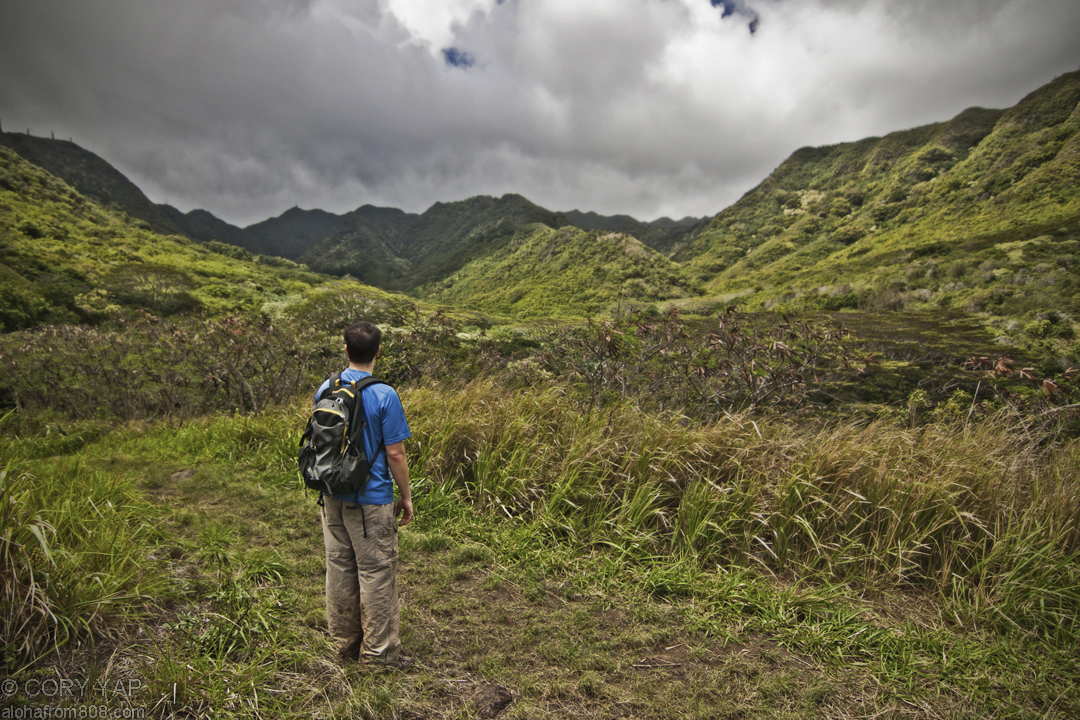
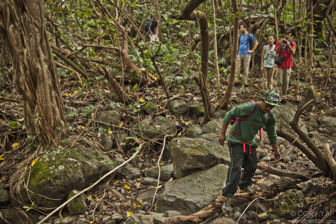
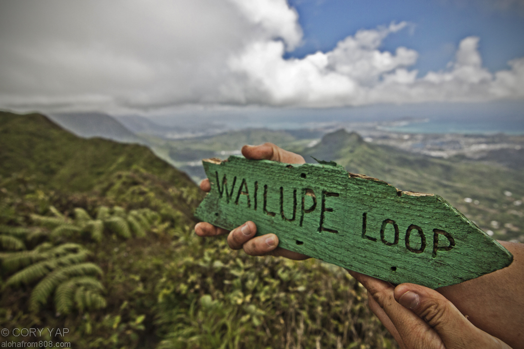
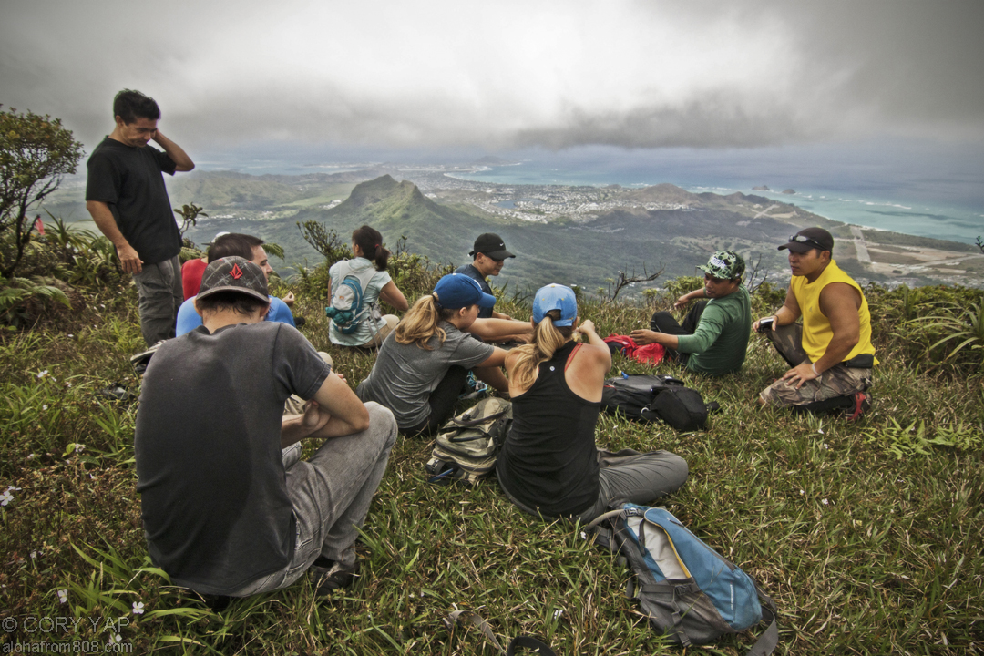
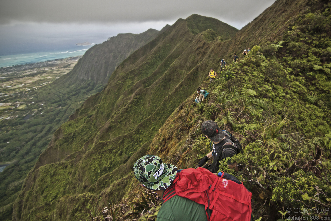
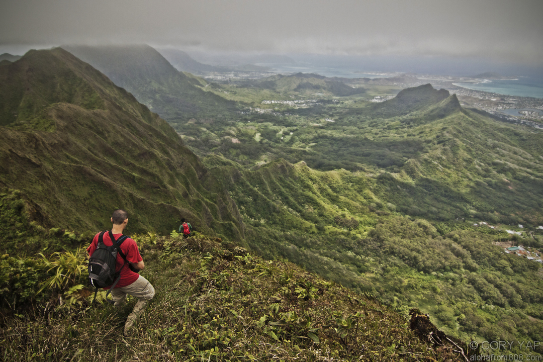
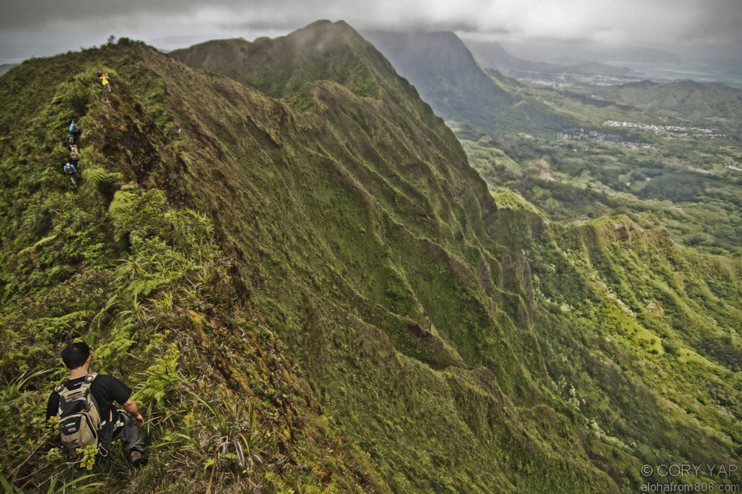
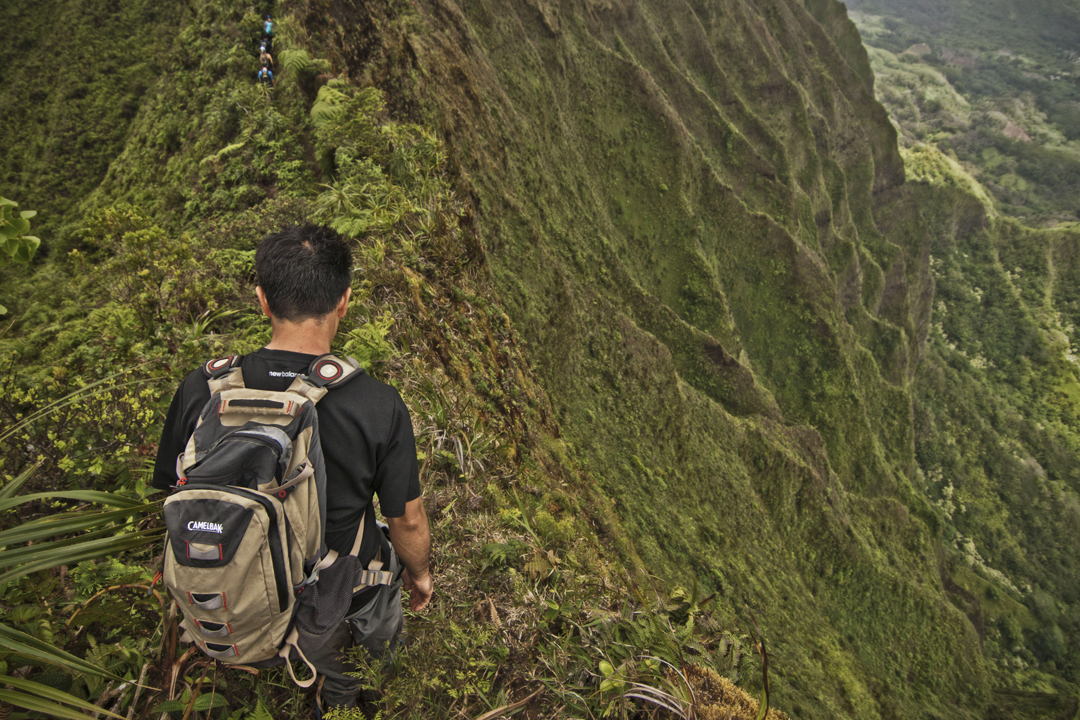
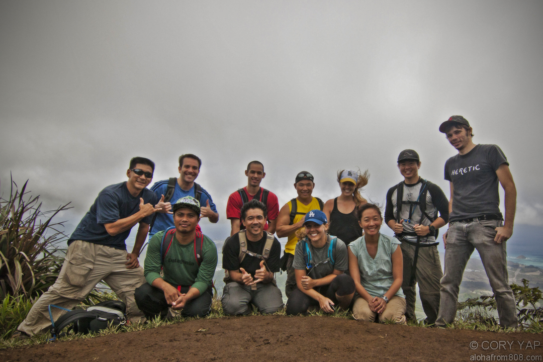
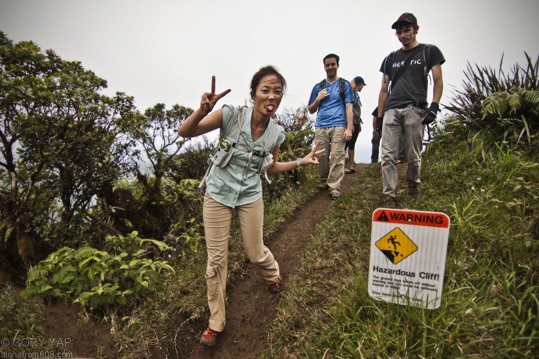
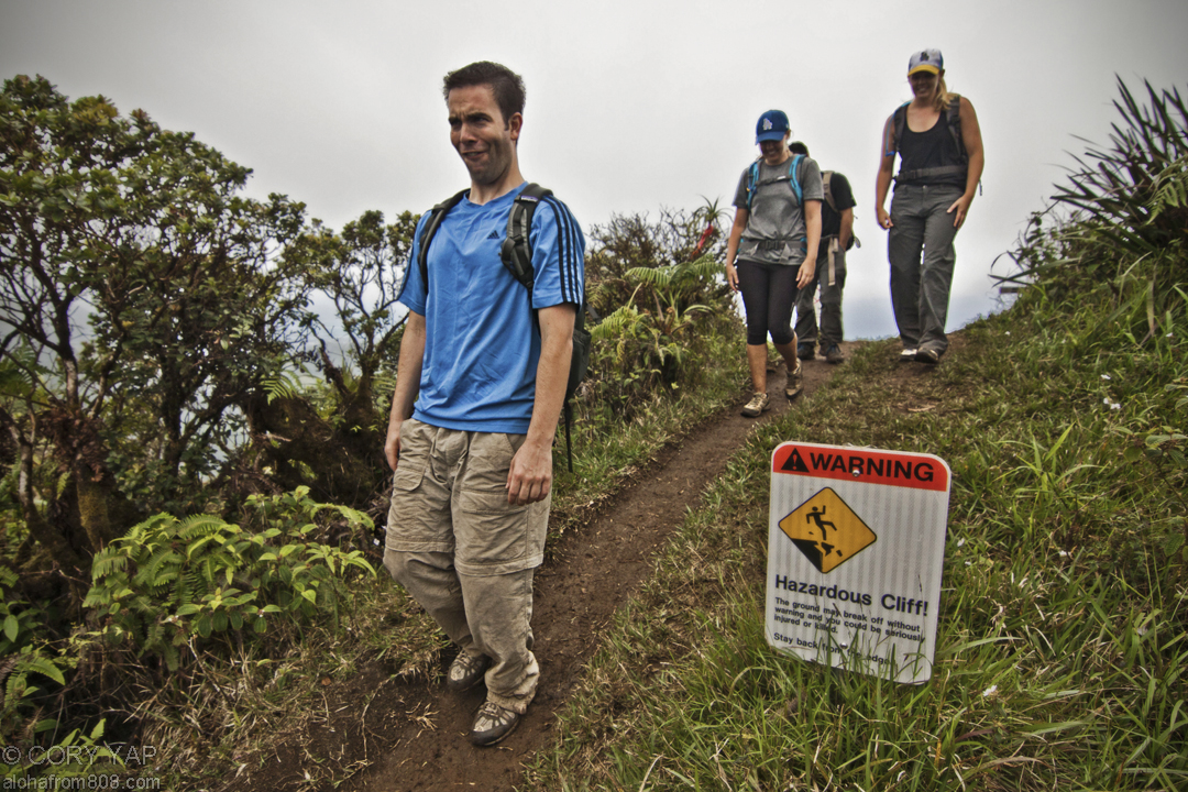
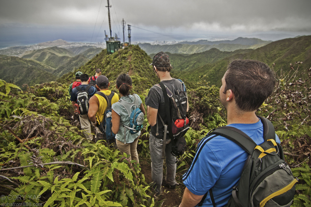
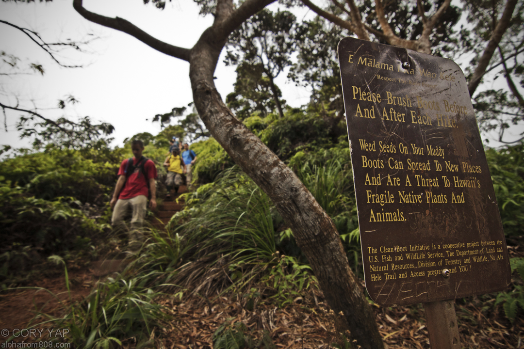
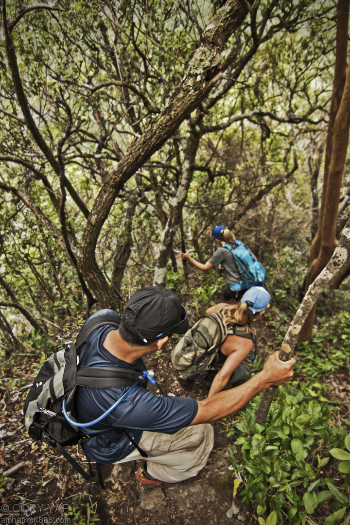
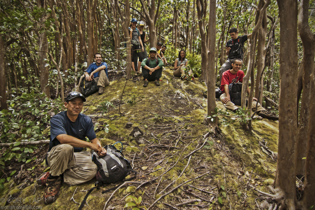
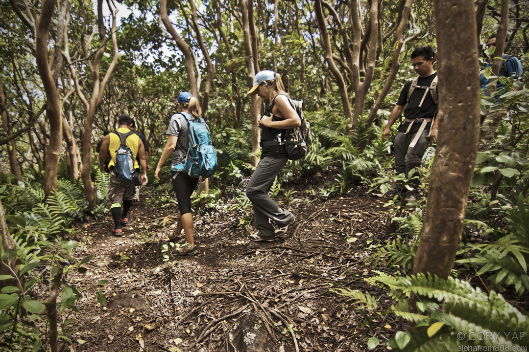
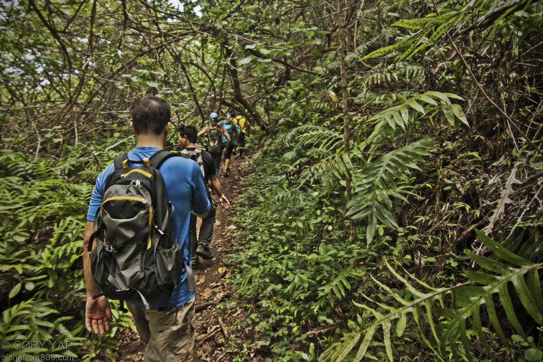
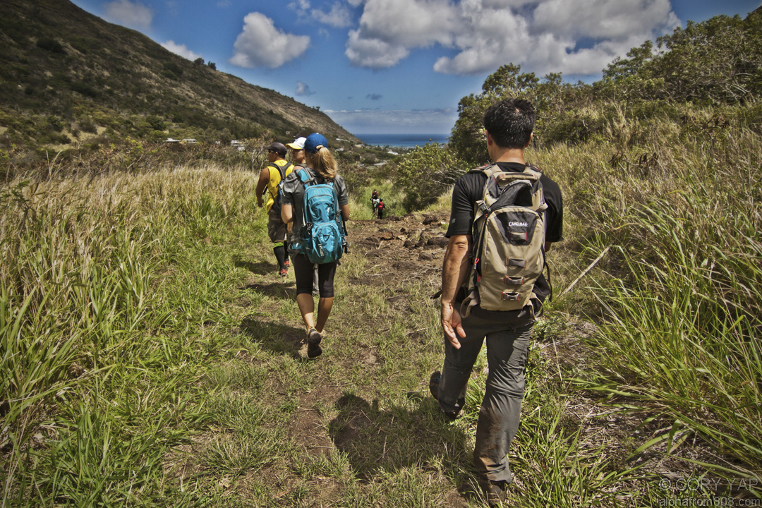
      The heavy rains from a recent, mild tropical storm made for perfect conditions...
    • Koolau Summit Trail: Manana to Waiahole Uka
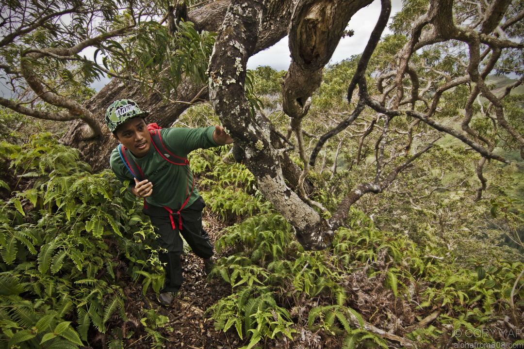
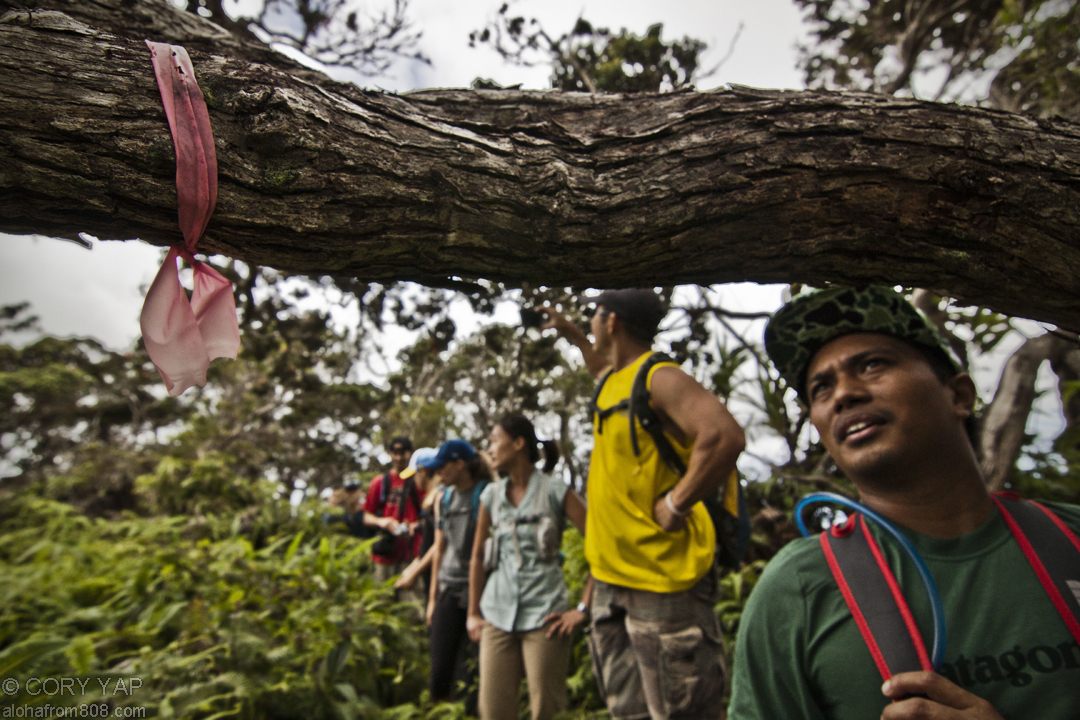
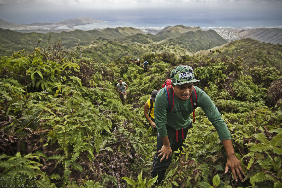
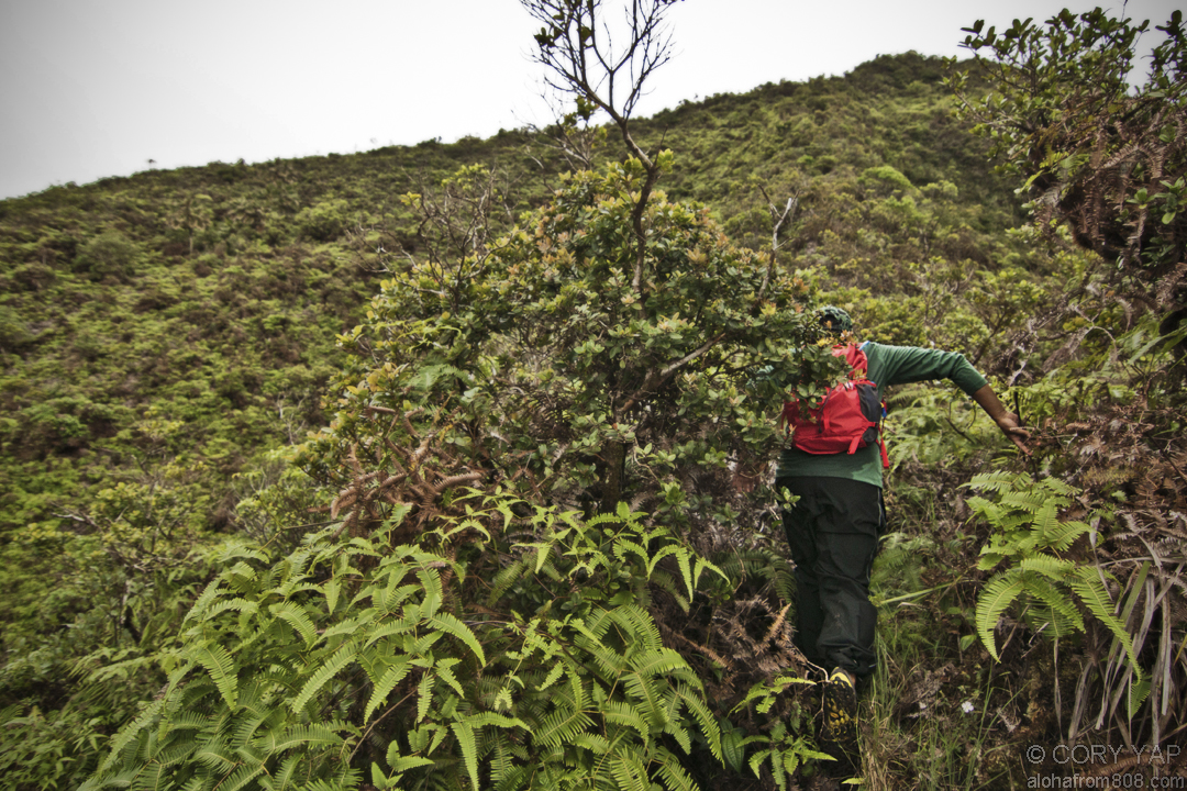
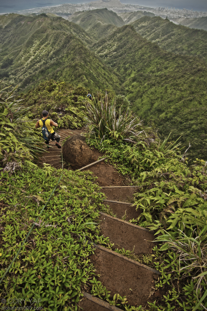
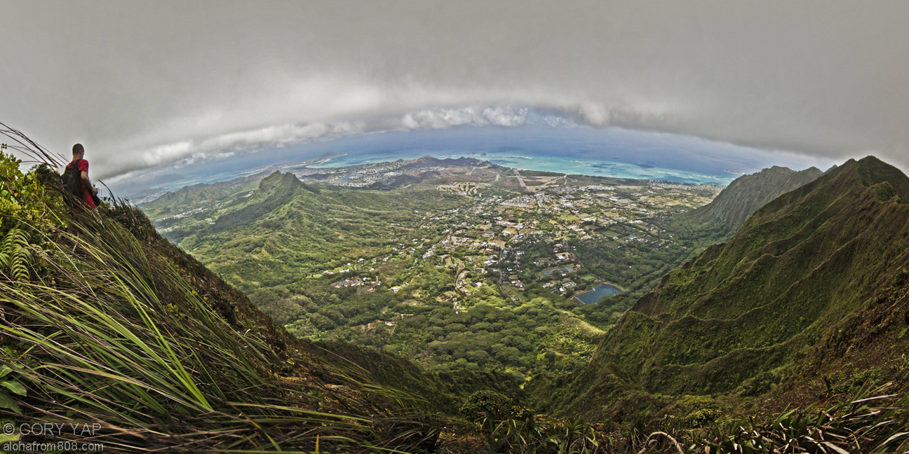
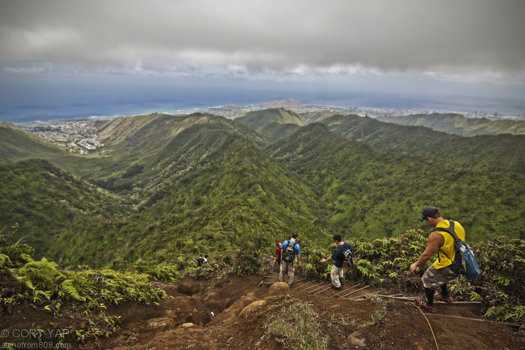
      With high clouds and an open summit, traversing the section of the Koolau Summit...
    • Aotearoa - New Zealand, South Island Pt 3
      STAY TUNED for more photos and full description of our New Zealand Adventures!!! Queenstown...
  • See Older Posts

    • November 2014 (1)
    • October 2014 (4)
    • March 2014 (3)
    • January 2014 (1)
    • December 2013 (3)
    • November 2013 (3)
    • October 2013 (3)
    • September 2013 (3)
    • August 2013 (4)
    • July 2013 (3)
    • June 2013 (6)
    • May 2013 (2)
    • April 2013 (5)
    • March 2013 (4)
    • February 2013 (4)
    • January 2013 (5)
    • December 2012 (5)
    • November 2012 (4)
    • October 2012 (6)
    • September 2012 (2)
    • August 2012 (5)
    • July 2012 (5)
    • June 2012 (6)
    • May 2012 (8)
    • April 2012 (4)
    • March 2012 (7)
    • February 2012 (6)
    • January 2012 (9)
    • December 2011 (6)
    • November 2011 (11)
    • October 2011 (8)
    • September 2011 (9)
    • August 2011 (10)
    • July 2011 (12)
    • June 2011 (9)
    • May 2011 (1)