DISCLAIMER: Aloha From 808 is solely created for recreational purposes and NOT intended for use as a guide. Please be responsible and respectful if choosing to visit locations I photograph, as you do so at your own risk and the risk of endangering others. This website and owner will not be liable for injury, medical/legal fees, fines or property damage as a result of viewing. Do not use content on this website without permission (see more).

All photos © 2011-2014 Cory Yap, unless noted.

Tubing Kaukonahua (North fork), Wahiawa


PLEASE BE SURE TO READ THE INFO AT THE END OF THIS WRITE UP BEFORE ATTEMPTING
I have noticed people trashing this trail (pack out what you pack in) in an in attempt to ruin this adventure for others, so I will not be giving any further info than what is described in this write-up.


One of the best adventures I’ve done on Oahu, tubing the “north fork” of Kaukonahua Stream in Wahiawa was a great way to spend a day outdoors… since all we basically had to do was stay afloat. Easier said than done???


Receiving an invite from Chenay (808 Goonies) and Pete, we (Nate, Elisa, August, Dave, Jenelyn and I) started our amphibious adventure above one of the residential areas in Wahiawa.


Within minutes from the trailhead, we were descending down a steep muddy hill into the valley, through a forest of giant Paper Bark trees…


Near the valley floor, we crossed a small tributary of Kaukonahua Stream, of which had several fallen trees connecting the channel banks.


After a short uphill trek, we came to a bifurcation that could take us either down to the main stream channel (left turn) or continue on the ridgeline (right turn), mauka. We followed Pete down to the stream, where he set up what looked like the the colorful flagged transect lines we use for stream survey work… little did I know at the time, this was our finish line. lol.


Hiking back up to the bifurcation, we continued up on the ridgeline for about an < hour or so until we came to a steep trail which lead us back down into the valley (which is where the loop trail heads back downstream). Pete points out where we'd likely be starting point, near some riffles and exposed boulders.
Once at the bottom of the trail and crossing the stream, we inflated our inflatables… Note Dave’s sick lounge chair w/ cup holder included.


I don’t think I’ve ever blown up an inner tube before, but damn… it takes a really long time. Water-wings… not so much.


It may have been just me, but I haven’t been excited to do anything this great in a long time. lol. It was like Christmas morning for a 5 year old Cory. 🙂


Looking as if the stream was going to be a bit rough, I quickly tanked my Boddingtons for some liquid courage. haha.


…and it’s good thing too, cause I’m pretty sure I would have spilled it.


However, not all of the ride was rapid-like in nature. Much of the journey was quite leisurely and only required minor steering/ruddering with our hands.


On some of the more shallow, problematic areas, we had to rock hop downstream… so glad we brought our felt-bottomed tabis!!!


Further downstream, there was a cobble beach which makes a nice place to stop and have lunch… but since it was on a sharp bend, I could assume it may not be there if a large flood would easily move the sand off the stream bank.


I have to admit, I was pretty jealous of Dave. His lounge chair allowed him to go through almost all of the rough areas since he was much more elevated out of the water. Going through some of these parts on an innertube resulted in bruised tailbones and flipped tubes… Trust me, I know first hand. haha. Learning the hard way, we found that erecting our bodies, parallel to the stream bottom was best when going over shallow rocks.


After what was probably ~3.5 hours of floating downstream, we approached the finish line!


Which was welcomed, as most of us were pretty cold by this point… note everyone throwing on their jackets and dry clothes, hehe.


…and off to climb the “hill of tears” through the paperbark tree grove. Cardiac hill got nothing on this!!!

Next stop Maui Mikes!

Mahalo nui loa for the invite and hosting such a great adventure. Good times with a fun crew! 😉


GoPro video of our adventure downstream from Jenelyn Castillo. 😉

Although the above documentation was not intended as a guide, I can only assume people will try to come here as “unprepared” as possible. For our adventure, we were prepared with one or two back-up tubes (or patch kit), and a good thing too, since several members of our group popped theirs on submerged branches and logs along the stream. Neoprene vests or wetsuit tops helped us endure partly submerging in the cold stream water over several hours of tubing… particularly since the weather up here is usually overcast / shaded from the riparian cover. It is critical to map out exit routes prior to floating downstream, as it is not unreasonable to tube into the upper reaches of Lake Wilson… which is probably not where most people want to be. DO NOT go tubing during heavy rains unless you have a helmet and gills, as a flash flood will likely result in drowning… and again in Lake Wilson. On the other hand, dryer summer months may leave the stream too dry for tubing.


I typically check the USGS current streamflow conditions for Hawaii (i.e. for the Northfork of Kaukonahua Stream) and the National Weather Service forecast conditions for the upper reaches of Wahiawa, before planning any type of adventure. I’d typically shoot for stable heights near 2.5 ft, however Hawaii’s stream conditions are often flashy. The gauge base height is probably near 1.5 feet, and in my opinion, levels < 2.0 ft are probably too shallow for "fun" and will likely produce more rock-hopping, rather than floating. I do not like tubing on anything > 3 ft, since the water is moving exponentially faster… so much so that most people can not even walk across the stream without being swept away. Please be responsible and not endanger others by exceeding your comfort zone. Plan accordingly and keep the safety aspect a priority over having “fun.”

Keep in mind that leptospirosis is present in virtually all Hawaiian Streams, and swimming or other water activites in them will put you at risk of contracting the bacterial disease. If exhibiting any of the flu-like symptoms after the activity, seek medical attention immediately. MOST IMPORTANTLY, keep track of your crew and stay together. As it is easy to get separated, I highly recommend the ‘buddy system…’ Thus, if anyone falls behind make sure to wait for them!!!

Also EXTREMELY IMPORTANT, please respect the residential community in this area. This is their neighborhood, and most people who do this activity park in front of their homes. Do not leave mud or litter in their driveways or on curbs, nor attempt to use their water hoses to wash off. Also if hiking in early in the morning, I’m sure they would appreciate it if you keep the noise to a minimum. There is also a bus route that passes through this area, so please be mindful when the streets are narrow or when considering parking near turns (I hear there will be a series of “parking signs” being erected in the near future). One of the reasons why the Haiku Stairs (aka Stairway to Heaven) was shut down was because of the upset residents in that area, who were tired of dealing with disrespectful hikers who were exhibiting similar behavior to the above described.

Aloha and mahalo nui for visiting the site … come back again soon!

Recommend this post to others:


19 Comments for Tubing Kaukonahua (North fork), Wahiawa


Bean

Hey, inspirational hike and photos. I’m planning on taking a group to Hike up the Schofield Waikane trail and want to incorporate a tube down the river on the return leg. I was planning on starting the tubing from the Gaging Station (Mauka Ridge Trail Branch off of Schofield Waikane trail leads to it). Can you show me on a topo exactly whereabouts you guys started tubing and what you think of the stream conditions above and below that point.
-Mahalo nui loa
Bean

Reply

    Cory

    Aloha Bean,

    Just sent you an email with more info. Thank you for your praise and for visiting my site. If you attempt what you say, stay safe and good luck!!!

    Cory

    Reply

Sean

Aloha Cory,

I actually saw this trip on Nathan Yuens photography page earlier today, and was doing a bit more research when I came across your page. Looked like an incredible experience man.

Same as Bean asked, can you show me a topo of where you guys started and the route to get there? I’m gonna go survey it next week and hopefully get everyone out there on the 26th or 27th. Hopefully it won’t be too dry by then.

Thanks for any help!

-Sean

Reply

    Cory

    Aloha Sean,

    Just sent you an email, but let me know if you have any more questions! Mahalo for checking out my site!

    Cory

    Reply

Emilie

I really want to get more involved with hiking oahu. I have done a couple hikes but the good ones require you to know someone. If you ever want a hiking buddy or dont mind someone tagging along. I would love to join!

Reply

    Cory

    Aloha Emilie,

    That’s awesome that you want to get more into hiking here… There are a lot of great hikes out there, and most of the common ones are described in local blogs. One of the best places to meet other Oahu hikers, is by joining “Oahu Weekend Hikers,” a hiking group/forum on Facebook or by finding a local MeetUp hiking group. Several people post open hikers in the forum, or you can just opening ask if anyone is hiking on a specific day. See you in the forum or on the trails! Mahalo for visiting my site!

    Reply

kw

Recently went and played on the Kahana river and while researching other rivers we could ride on, we came across your blog. Wondering if you would be able/wiling to give more detail of where abouts u started on the river (since I think you cross it several times) and the route you took to get there. Would like to try and check it out. Thanks for sharing your adventure and for any help you can give.

Reply

    Cory

    Aloha Kw,

    Mahalo for taking the time to check out my website. I’ll further contact you by the email you provided.

    Cory

    Reply

Pat

Hey Cory,
Stumbled upon your adventure on here .Thanks for sharing.
I have an inflatable SUP with small fins and wanted to try a run down the river.
Do you think this would be possible. probably need some water, but not too much.
Can you send me the map?

P

Reply

    Cory

    Aloha Pat,

    I don’t have a mapped route, only one that shows the general area we tubed. I’m not sure if a SUP would work since there are so many rocks there. Taking a spill on one could be disastrous. I feel the air filled devices are better since they cushion the blow of the rocks as you go over them. Someone else also complained to me about there not being any rapids when they went… The base height (height of the stream on a typical day), is not very high. I check the USGS site for stream flow here. Anything over 3 ft should not be attempted since the water is moving so fast that you cannot stand up. ~2.5 ft should be okay for most… but that really depends on comfort level. People who complain probably did it when it was < 2 ft (See below). Stay safe and have fun! Let me know if you have any more questions!

    Reply

Pat

Thanks for the response.
You mind to send me any maps and info you have on the river?
How many spots did you have to stop for rocks?
The inflatable SUP will cruise over most rocks and is stable enough to stand up on for the most part.
Just was wondering how to get to the launch spot. Are the directions from Kaleo Lancaster to the starting point of the tube run?
Really want to try this.
Thanks again

P

Reply

    Cory

    Aloha Pat,

    I just emailed you at the address you sent. Hope the info helps.

    Cory

    Reply

Carlos

Dont try to float down the entire river, 4 plus hours floating and walking over slippery rocks is definitely not what we were planning on… Lesson learned? Bring more water and a lighter. We almost spent the night on the river. Only by the grace of God did someone leave a rope to climb up a cliff to a well marked trail that led us up to wahiawa heights. Rocks ruined it for us and I truly hope the people behind us didn’t sleep next to the river, all of us were unprepared. Good luck

Reply

    Cory

    Aloha Carlos,

    Glad you folks got out safely and thank you for validating all the safety precautions I have posted in this write-up…. it sounds like you did exactly the opposite of what I recommended. In addition, the majority of people who I know that have done this do not require more than a liter of water for the entire trip (hiking/tubing), however most people can figure out how much they need by first bringing more than they should need. A lighter probably wouldn’t have helped you much either under the circumstances. There are too much negative publicity on hiking nowadays, and it’s because of unprepared people who are going to ruin areas like this for others who are more responsible. Please stay safe out there and be responsible hikers.

    Mahalo for checking out my site,

    Cory

    Reply

sheena

Hi there! i lived here all my life but moving soon to vegas. I was looking for something adventurous but nothing too extreme to.do before permanently leaving. Do you mind sharing the route and if possible to take me and one of my gf there?

Reply

    Cory

    Aloha Sheena,

    Sorry for not getting back to you sooner as I’ve been traveling quite a bit recently. I don’t have a GPS track of the route unfortunately. I love doing this activity when the conditions are right, however those conditions don’t occur regularly and make it difficult to plan. You can try and join the facebook group “Next Peak,” which is the group that is most “on top of” planning this activity. I may or may not be available to join when they do, but it may be your best bet if you need assistance. If not, the above information is definitely a lot to start with, as well as the other information I suggested checking out. Let me know if you have any more questions, if not, good luck and stay safe.

    Mahalo for checking out my site,

    Cory

    Reply

Annie

Aloha,

I would like to get a group of friends together to do this adventure. Wanting to go in November. Hoping the water level will be high enough but no flash floods. Wondering if I could get more information from you, most importantly about where you started and ended? Mahalo!

Reply

    Cory

    Aloha Annie,

    We started off of the Wahiawa Hills Loop and launched at the upper part of the loop that crosses the river. Make sure you mark where you get out ahead of time, near the bottom of the loop. I’ve heard of people having VERY negative experiences here, but it is because of their lack of preparedness and acknowledging when they are “in over their heads.” Don’t force the activity, just have it as a backup if the conditions are right for you… the last time I went it was really dangerous since the water was high and people got banged up pretty good. It is not like this typically, but you just don’t want to go at the wrong time. We are fortunate enough to approximately know when these conditions are because of the gauging station located upstream there. Good luck and PLEASE stay safe, unlike one of the other commenter above.

    Mahalo nui for checking out my site,

    Cory

    Reply

      Annie

      Hi Cory,

      Mahalo for your response. I definitely appreciate the feedback. We will definitely make sure the conditions are right for it before attempt it. I’m just wondering if you have any more information about where to park cars (do we need to park in two different locations? and where exactly do we park for the beginning of the Wahiwa Hills Trails loop? Also, do you have any more information about the trail and how to get to the best input spot for the river? Any additional instructions via email (as you mention you have sent to others) would be appreciated 🙂 thanks!

      Reply


Wanna say something?


  Cancel Reply


  • Follow Aloha From 808 on Facebook or Instagram for new photos and weekly adventures!!!

  • Adventures

    • Backpacking (29)
    • Beach / Coastal (46)
    • Climbing / Canyoning (15)
    • Conservation / Restor… (11)
    • Fishing / Diving (22)
    • Hiking (149)
    • International (3)
    • Kayaking (11)
    • Mainland US (17)
    • Streams / Waterfalls (61)
    • Uncategorized (12)
  • Recent Posts

    • Canyoneering: Communication Breakdown
      Recently learning how to rappel from my friend Kitt, I was invited to tag along...
    • East Maui Waterfall Marathon Pt 2
      As a reconnaissance for future adventures with a larger group, Baron and I decided...
    • Twin Falls, North Kauai
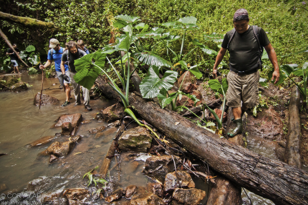
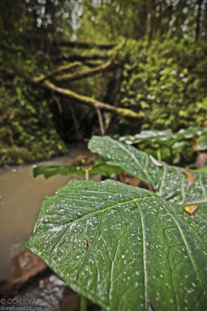
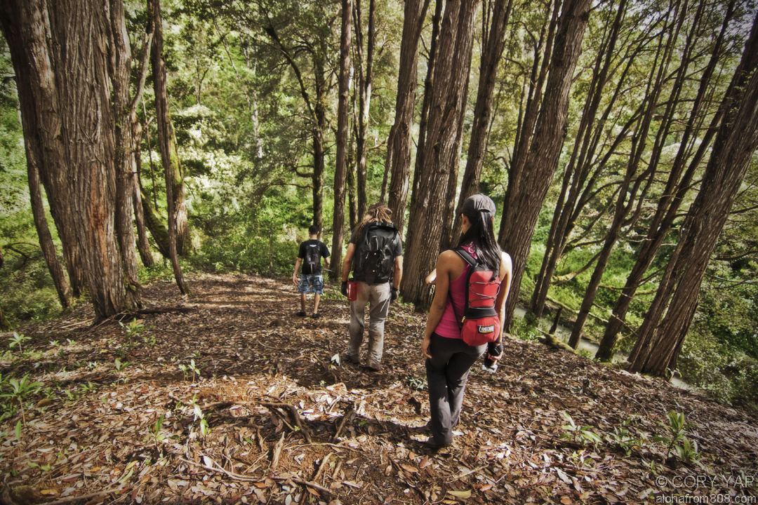
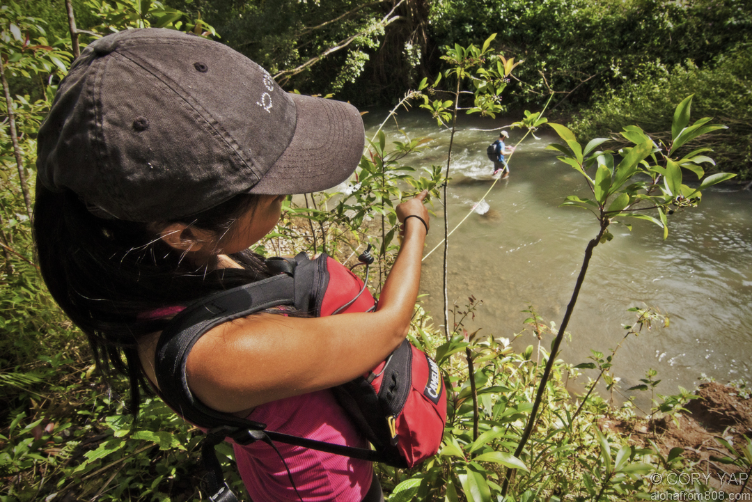
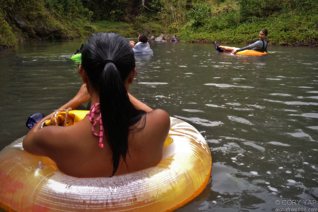
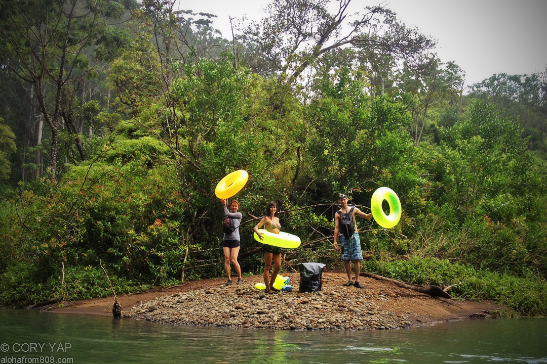
      One of my colleagues who lives / works up in North Kauai strongly recommended that...
    • Honolulu 27, Waterfall Loop
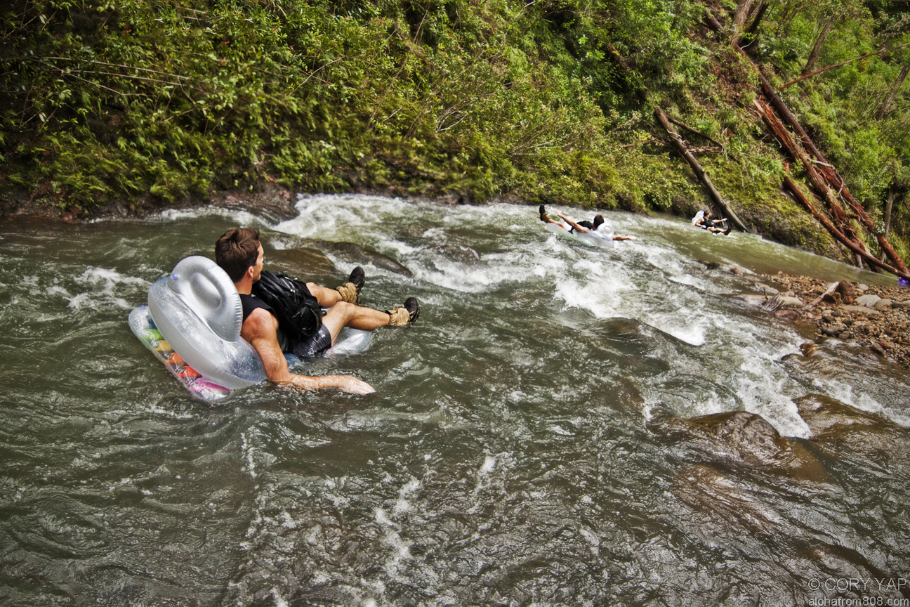
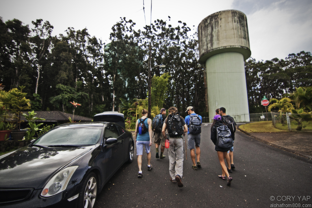
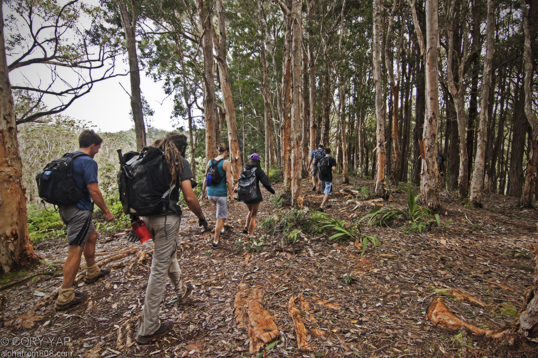
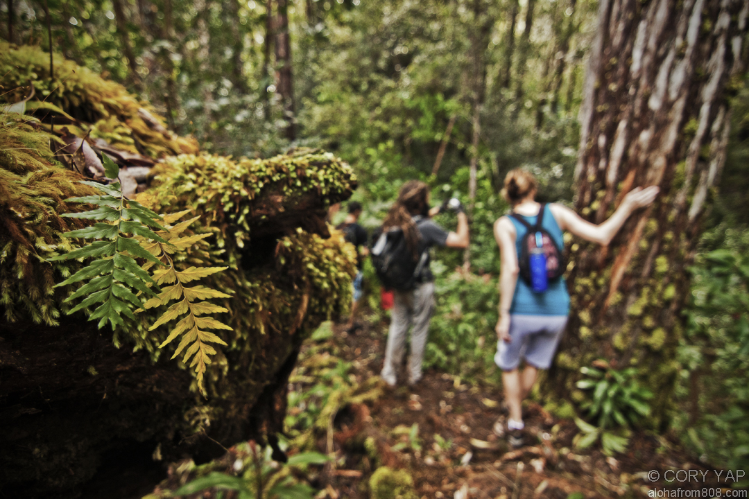
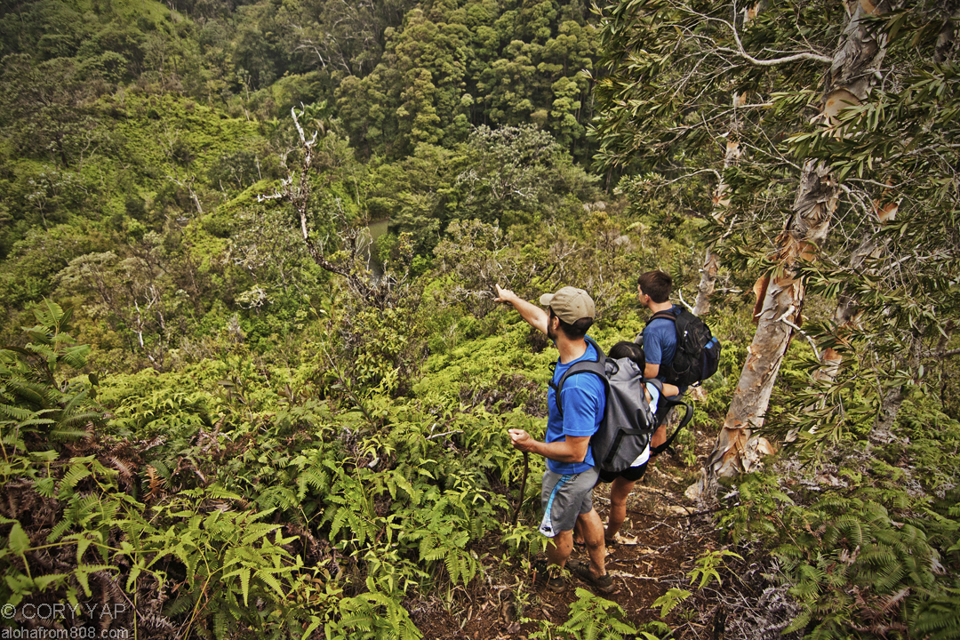
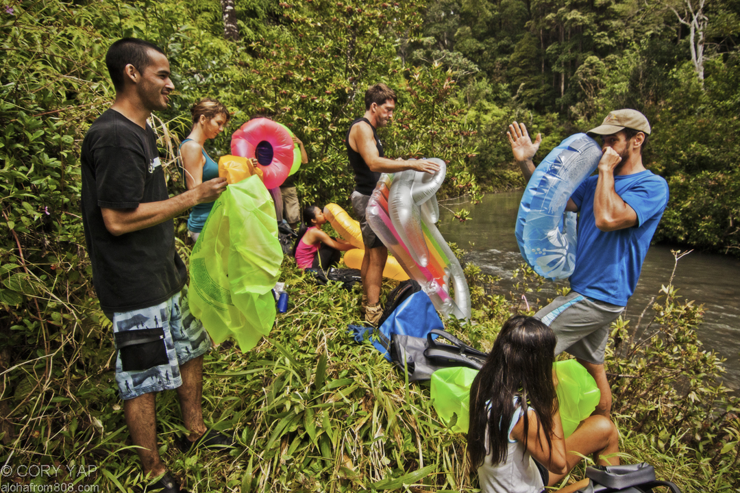
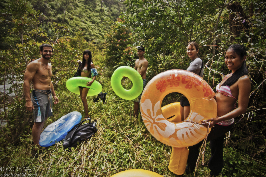
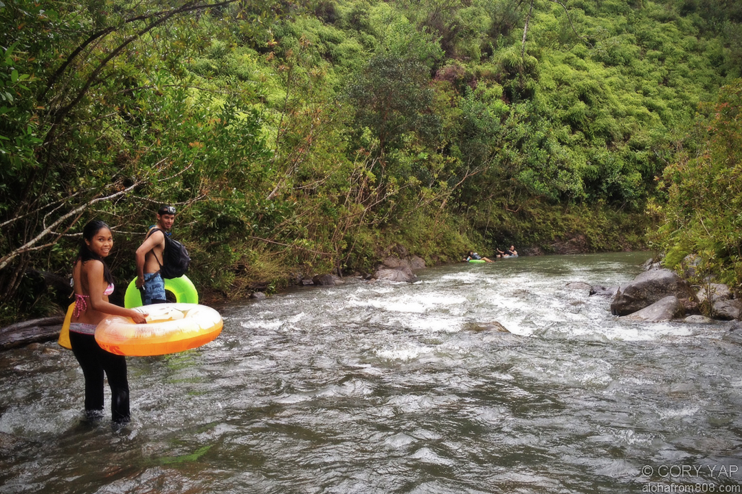
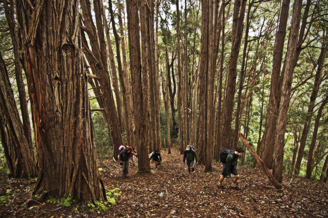
      The heavy rains from a recent, mild tropical storm made for perfect conditions...
    • Koolau Summit Trail: Manana to Waiahole Uka
      With high clouds and an open summit, traversing the section of the Koolau Summit...
    • Aotearoa - New Zealand, South Island Pt 3
      STAY TUNED for more photos and full description of our New Zealand Adventures!!! Queenstown...
  • See Older Posts

    • November 2014 (1)
    • October 2014 (4)
    • March 2014 (3)
    • January 2014 (1)
    • December 2013 (3)
    • November 2013 (3)
    • October 2013 (3)
    • September 2013 (3)
    • August 2013 (4)
    • July 2013 (3)
    • June 2013 (6)
    • May 2013 (2)
    • April 2013 (5)
    • March 2013 (4)
    • February 2013 (4)
    • January 2013 (5)
    • December 2012 (5)
    • November 2012 (4)
    • October 2012 (6)
    • September 2012 (2)
    • August 2012 (5)
    • July 2012 (5)
    • June 2012 (6)
    • May 2012 (8)
    • April 2012 (4)
    • March 2012 (7)
    • February 2012 (6)
    • January 2012 (9)
    • December 2011 (6)
    • November 2011 (11)
    • October 2011 (8)
    • September 2011 (9)
    • August 2011 (10)
    • July 2011 (12)
    • June 2011 (9)
    • May 2011 (1)